ArtsAutosBooksBusinessEducationEntertainmentFamilyFashionFoodGamesGenderHealthHolidaysHomeHubPagesPersonal FinancePetsPoliticsReligionSportsTechnologyTravel

Hiking to Finger Rock - A Photo Essay

Updated on December 12, 2017
Chuck profile image

Having lived in Arizona for over 30 years, Chuck and his wife enjoy exploring the great outdoors of the American Southwest.

Our First Attempt of the Season to Reach Finger Rock.

On Christmas Eve my son Victor, whose nom de plume on HubPages is Sith Penguin, and I decided to take some time away for Christmas preparations to go hiking.

For years we have been hiking the two trails in the Coronado National Forest that are near our home and lead to the top of Mt. Kimball which rises 7,255 feet above sea level or a little less than 5,000 feet higher than the elevation where we live.

We have talked about dropping one car off at the parking lot by the Pima Canyon Trailhead and driving to the Finger Rock Trailhead and hiking back over the mountain to the Pima Canyon parking lot but have never attempted it.

This year we would like to just get somewhere near the top of Mt. Kimball from either trail - or, at least reach Finger Rock - and, now that summer is over and the weather cooler we plan to begin launching more attempts to reach the mountain.

But on this day, we didn't start until 3:30 in the afternoon and our goal was to simply get some exercise and enjoy the spectacular scenery.

Finger Rock - This Season's First Objective
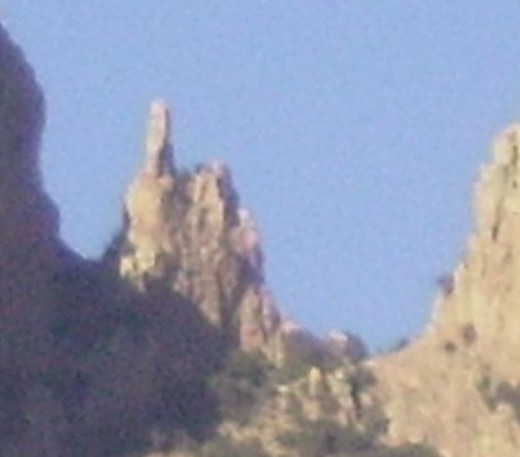
Finger Rock - so named because the approximately 100 foot narrow cylinder of rock looks like a finger pointing upward.
Finger Rock - so named because the approximately 100 foot narrow cylinder of rock looks like a finger pointing upward. | Source

Tucson, Arizona is located in a valley surrounded by four mountain ranges.

The Santa Catalina Mountains, in which Finger Rock is located, stretch along the northern edge of Tucson.

The Santa Catalina’s are the largest and highest mountain range bordering the city with peaks rising as much as 9,000 feet.

As can be seen on the map and pictures below, the city has expanded into the foothills of the Catalina’s with homes being built right to the base of the towering mountains.

To the west of the city are the Tucson Mountains which are the smallest of the four mountain ranges that surround the city. The highest point, Wasson Peak, is only 4,687 feet high.

Living on the northwest side of town, we are close to both of these mountain ranges and enjoy hiking in both of them. The other two mountain ranges, the Rincons on the east side of the city and the Santa Rita Mountains which are located forty miles south of Tucson, are more distant from us and thus rarely visited by us.

Map Showing Locations of Trail Head and Finger Rock

A
Richard McKee Finger Rock Trailhead N Alvernon Way, Catalina Foothills, AZ:
North Alvernon Way, Catalina Foothills, AZ 85718, USA

get directions

Start of Finger Rock Trail at the foot of the Santa Catalina Mountains where N. Alvernon Way in Tucson, AZ 85718 ends.

B
Finger Rock, Pima, AZ:
Finger Rock, Coronado National Forest, Arizona 85718, USA

get directions

Distance from trail head is approximately 3 miles with Finger Rock with the trail rising about 3,800 feet between the trail head and the rock.

Finger Rock is located in the Santa Catalina Mountains and the trail head begins at the base of the mountains right where Alvernon Way ends.

Along the west side of Alvernon Way, just before the trail head, is a parking lot which is open during the day and offers free parking for those using the trail. Parking is not allowed on the street along Alvernon Way.

Paved roadways go off to the left and right at the end of Alvernon Way but these only provide access to homes in the gated communities on either side of Alvernon Way.

These expensive homes in these communities are built right along the edge of the base of the mountain and their back yards are easily viewed from the trail.

Directions To Finger Rock From Central or East Tucson

From central or east Tucson turn north off of any of the major east-west streets (22nd Street, Broadway Blvd, Speedway Blvd., Grant Road, etc.) on to Swan Road and continue north to Skyline Drive.

Turn left on Skyline Drive and, staying in the right lane, head west to Alvernon Way.

Turn right on Alvernon Way and go to the end.

The free parking lot will be on the left just before Alvernon Way ends.

Directions to Finger Rock Train from I-10 and West Tucson

If you are traveling on Interstate-10 on Tucson's west side, you can take either the Ina Rd (Exit 248) or Orange Grove Road exit 250 east from the Interstate. You can also head east on either of these two roads from Oracle Rd.

Between North 1st Avenue and Campbell Ave, Ina Road will bend to the right and become East Skyline Drive. Continue on Past Campbell a short distance to a sign indicating to veer to the left for Skyline Drive while the main portion of the road veers to the right and becomes E. Sunrise Drive

If you miss this turn off for E. Skyline Dr. continue in the left lane of E. Sunrise a short distance to the intersection of E. Sunrise and N. Swan Road. Turn left at the signal on N. Swan and follow the directions in the capsule above to reach Finger Rock via Swan Rd.

Continue a short distance on E. Skyline and you will see a sign instructing you to turn left ahead to reach the Finger Rock Trail.

Turn left on N. Alvernon Way and drive to the end where you will see the parking lot and trail head.

If you exit at Orange Grove instead of Ina Rd. simply follow Orange Grove to where it intersects and ends at E. Skyline Drive a mile or so past North 1st. Ave.

Turn right onto E. Skyline Drive and follow the directions above for Ina Rd.

Map Showing Roads Leading to Finger Rock Trail Head

A
North Alvernon Way, Catalina Foothills, AZ 85718, USA:
North Alvernon Way, Catalina Foothills, AZ 85718, USA

get directions

This home has a spectacular view - and equally spectacular property taxes.
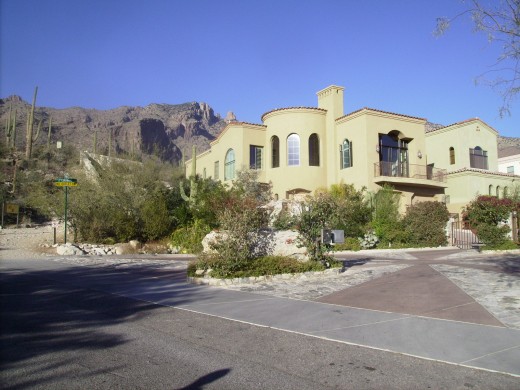
Beautiful home located next to start of Finger Rock Hiking Trail in Tucson, AZ
Beautiful home located next to start of Finger Rock Hiking Trail in Tucson, AZ | Source

Start of Trail - Finger Rock is straight ahead between the two peaks
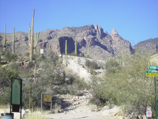
Start of Finger Rock Trail in Tucson, AZ. Finger Rock is just to right of peak on the left.
Start of Finger Rock Trail in Tucson, AZ. Finger Rock is just to right of peak on the left. | Source

2003 Forest Fire on Mountainalmost reached the homes we just passed.
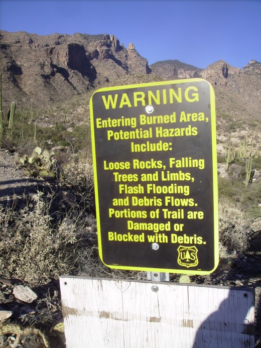
Sign at start of trail warning of debris from the Aspen fire that covered 84,730 acres and burned for a month in 2003
Sign at start of trail warning of debris from the Aspen fire that covered 84,730 acres and burned for a month in 2003 | Source

Homes on edge of Coronado National Forest
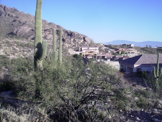
Homes next to Finger Rock Trail Head
Homes next to Finger Rock Trail Head | Source

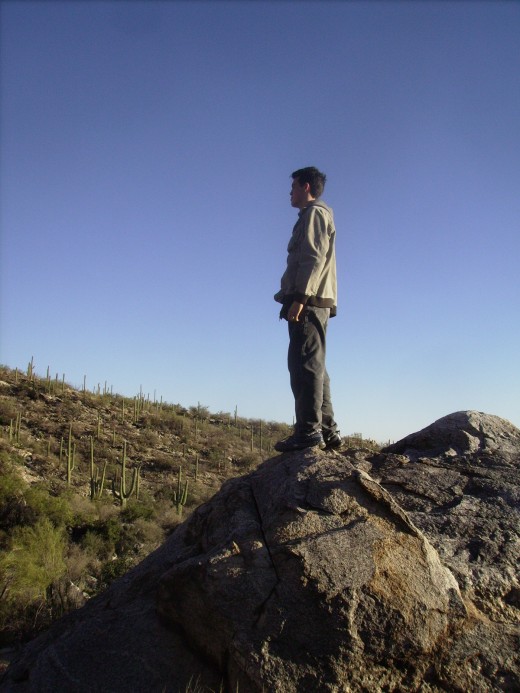
Victor Surveying Trail

Taking in the view along Finger Rock Trail in Tucson, AZ
Taking in the view along Finger Rock Trail in Tucson, AZ | Source

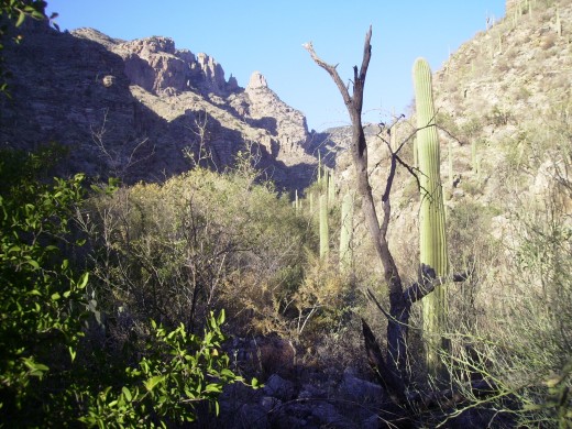
We advance up the canyon

Entering mouth of Finger Rock Canyon as we advance up the Finger Rock Trail
Entering mouth of Finger Rock Canyon as we advance up the Finger Rock Trail | Source

It's 4:15 & Time to turn back - With its zoom lens my camera appears to have gotten closer than we did.
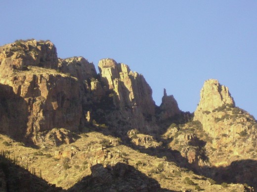
Finger Rock (fist with extended index finger) clearly visible between two peaks.
Finger Rock (fist with extended index finger) clearly visible between two peaks. | Source

Even on December 24th one can work up a sweat hiking in these parts.
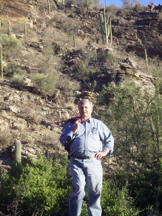
Even on December 24th, sans jacket and shirt sleeves rolled up, I am still hot from the hike
Even on December 24th, sans jacket and shirt sleeves rolled up, I am still hot from the hike | Source

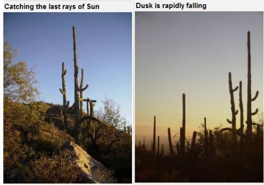
Sunset approaches

Side by Side photos show rapidly declining winter daylight as we approach end of Finger Rock Trail hike.
Side by Side photos show rapidly declining winter daylight as we approach end of Finger Rock Trail hike. | Source
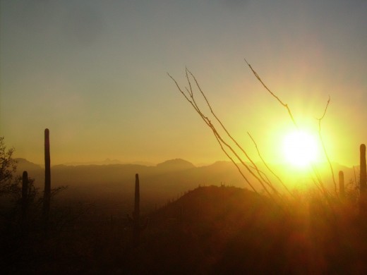
Sun setting over the Tucson Mountains as viewed from Finger Rock hiking trail.
Sun setting over the Tucson Mountains as viewed from Finger Rock hiking trail. | Source
Viewing Tucson valley from Finger Rock Trail Head as dusk descends over the city.
Viewing Tucson valley from Finger Rock Trail Head as dusk descends over the city. | Source

The Moon rising

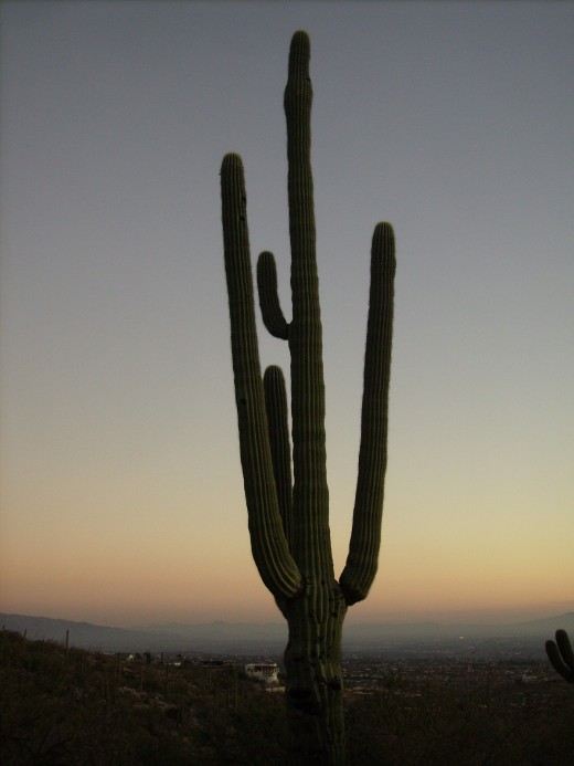
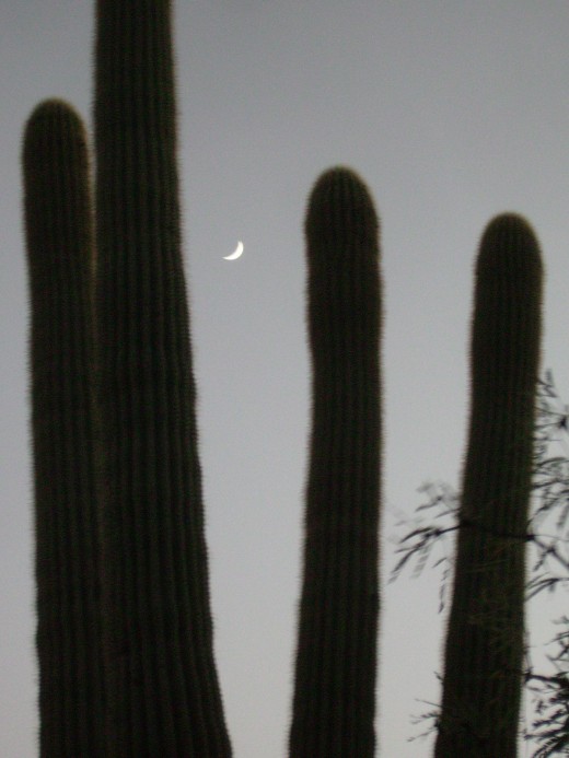
Moon rising between arms of a giant Saguaro Cactus at start of Finger Rock Trail in Tucson, AZ
Moon rising between arms of a giant Saguaro Cactus at start of Finger Rock Trail in Tucson, AZ | Source

And To All a Good Night

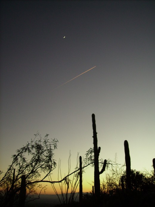
Dusk at Finger Rock Trail Head with crescent moon and contrails of a jet overhead.
Dusk at Finger Rock Trail Head with crescent moon and contrails of a jet overhead. | Source

© 2006 Chuck Nugent

working

This website uses cookies

As a user in the EEA, your approval is needed on a few things. To provide a better website experience, hubpages.com uses cookies (and other similar technologies) and may collect, process, and share personal data. Please choose which areas of our service you consent to our doing so.

For more information on managing or withdrawing consents and how we handle data, visit our Privacy Policy at: https://corp.maven.io/privacy-policy

Show Details
Necessary
HubPages Device IDThis is used to identify particular browsers or devices when the access the service, and is used for security reasons.
LoginThis is necessary to sign in to the HubPages Service.
Google RecaptchaThis is used to prevent bots and spam. (Privacy Policy)
AkismetThis is used to detect comment spam. (Privacy Policy)
HubPages Google AnalyticsThis is used to provide data on traffic to our website, all personally identifyable data is anonymized. (Privacy Policy)
HubPages Traffic PixelThis is used to collect data on traffic to articles and other pages on our site. Unless you are signed in to a HubPages account, all personally identifiable information is anonymized.
Amazon Web ServicesThis is a cloud services platform that we used to host our service. (Privacy Policy)
CloudflareThis is a cloud CDN service that we use to efficiently deliver files required for our service to operate such as javascript, cascading style sheets, images, and videos. (Privacy Policy)
Google Hosted LibrariesJavascript software libraries such as jQuery are loaded at endpoints on the googleapis.com or gstatic.com domains, for performance and efficiency reasons. (Privacy Policy)
Features
Google Custom SearchThis is feature allows you to search the site. (Privacy Policy)
Google MapsSome articles have Google Maps embedded in them. (Privacy Policy)
Google ChartsThis is used to display charts and graphs on articles and the author center. (Privacy Policy)
Google AdSense Host APIThis service allows you to sign up for or associate a Google AdSense account with HubPages, so that you can earn money from ads on your articles. No data is shared unless you engage with this feature. (Privacy Policy)
Google YouTubeSome articles have YouTube videos embedded in them. (Privacy Policy)
VimeoSome articles have Vimeo videos embedded in them. (Privacy Policy)
PaypalThis is used for a registered author who enrolls in the HubPages Earnings program and requests to be paid via PayPal. No data is shared with Paypal unless you engage with this feature. (Privacy Policy)
Facebook LoginYou can use this to streamline signing up for, or signing in to your Hubpages account. No data is shared with Facebook unless you engage with this feature. (Privacy Policy)
MavenThis supports the Maven widget and search functionality. (Privacy Policy)
Marketing
Google AdSenseThis is an ad network. (Privacy Policy)
Google DoubleClickGoogle provides ad serving technology and runs an ad network. (Privacy Policy)
Index ExchangeThis is an ad network. (Privacy Policy)
SovrnThis is an ad network. (Privacy Policy)
Facebook AdsThis is an ad network. (Privacy Policy)
Amazon Unified Ad MarketplaceThis is an ad network. (Privacy Policy)
AppNexusThis is an ad network. (Privacy Policy)
OpenxThis is an ad network. (Privacy Policy)
Rubicon ProjectThis is an ad network. (Privacy Policy)
TripleLiftThis is an ad network. (Privacy Policy)
Say MediaWe partner with Say Media to deliver ad campaigns on our sites. (Privacy Policy)
Remarketing PixelsWe may use remarketing pixels from advertising networks such as Google AdWords, Bing Ads, and Facebook in order to advertise the HubPages Service to people that have visited our sites.
Conversion Tracking PixelsWe may use conversion tracking pixels from advertising networks such as Google AdWords, Bing Ads, and Facebook in order to identify when an advertisement has successfully resulted in the desired action, such as signing up for the HubPages Service or publishing an article on the HubPages Service.
Statistics
Author Google AnalyticsThis is used to provide traffic data and reports to the authors of articles on the HubPages Service. (Privacy Policy)
ComscoreComScore is a media measurement and analytics company providing marketing data and analytics to enterprises, media and advertising agencies, and publishers. Non-consent will result in ComScore only processing obfuscated personal data. (Privacy Policy)
Amazon Tracking PixelSome articles display amazon products as part of the Amazon Affiliate program, this pixel provides traffic statistics for those products (Privacy Policy)
ClickscoThis is a data management platform studying reader behavior (Privacy Policy)